- Free State Online
- Departments
- Office of the Premier
- Agriculture & Rural Development
- Education
- Health
- Coorporative Governance & Traditional Affairs
- Public Works & Infrastructure
- Police, Roads & Transport
- Social Development
- Sport, Art, Culture and Recreation
- Economic, Small Business Development, Tourism & Environmental Affairs
- Human Settlements
- Treasury
- Municipalities
- Entities
Tourism
San Rock art in the district, less than 20km from Bethulie, gives evidence of the early San in the area, while the movements of the Voortrekkers, and the strife of numerous wars can be seen all over area.

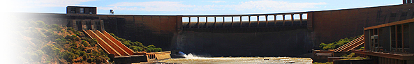
The DH Steyn Bridge connects the Free State to the Cape and frames one of the Horizons of Bethulie. It is a combined road and railbridge is the longest in the country (1,2km).
Tussen die Riviere Nature Reserve
Visit Tussen die Riviere Nature Reserve with its rhino, zebra and variety of antelope or the Mynhardt Game Reserve, which has a variety of antelope species.

Pellisier House Museum

The museum, which is at 1 Voortrekker Street, is housed in the original mission station buildings and depicts the history of the area, including an exhibition on the Anglo-Boer War and concentration camp. The museum was built in 1834-1835 by C Gosseling by craftsman of the French Mission Society as residence for the Reverend Jean P Pellisier, a French missionary of the Paris Mission Organisation.
Phillipolis
The oldest town in the Free State, Phillipolis/Poding-tse-Rolo serves as a general agricultural service centre within Kopanong. It is situated approximately 53 km southwest of Trompsburg. Access to the town is via the R48 between Koffiefontein and De Aar. The main social and economic functions of the town includes; key regional tourist destination, secondary agricultural service centre and social functions such as residence, education and medical services. A new television transmission sub-station was launched recently and this will enable the local community to follow all the action of the FIFA 2010 World Cup.
Tiger Canyons
Tiger Canyons is located near the town of Philippolis on the Van der Kloof Lake and was established as an experiment to create a free-ranging, self-sustaining tiger population outside Asia. From this population, third and fourth generations of tigers can be returned to Asia into parks that meet a set of criteria which give the tigers a chance of surviving in Asia. A lion cub was into a tiger litter to test if a tigress would adopt a cub which is not their own. This way genetic diversity can be increased in populations of wild tigers where inbreeding is occurring.

Jagersfontein
The original farm on which the town stands was once the property of a Griqua, Jacobus Jagers, hence the name Jagersfontein. Founded in 1870, Jagersfontein, is the world’s oldest diamond-mining town and the 1st place where diamonds were discovered in its mother stone or blue ground, or as it is now known, Kimberlite. Jagersfontein is the home of the blue-white-jagger-diamond. The largest numbers of the worlds biggest gem stone diamonds of exceptionalquality were produced here. Of the ten biggest diamonds ever found in the world, two came from this mine. In 1893, The “Excelsior” diamond, a diamond of 972 carats was discovered and it was described as a stone of the purest water – today known as a blue white diamond. Its present day value is estimated at approximately R 1, 2 Billion.

In 1895, a 637 carat diamond, the Reitz Diamond was discovered here. It was first named after Francis William Reitz, then state president of the Orange Free State in which Jagersfontein was located. The following year marked the Diamond Jubilee of Queen Victoria (the 60th anniversary of her coronation) so the gem was renamed the Jubilee Diamond to commemorate the occasion. Jagersfontein has a big hole that was dug by hand from 1870 until 1909 & the top area measures 19,65ha in comparison to Kimberley’s 17ha hole. To view the hole, one gets pointed to the museum where the heritage of Jagersfontein is to the marvellous satisfaction in one’s imagination, with olden day transportation and various tools that explain the presence of the world’s largest hand-dug vertical open mine.
Fauresmith
The town of Fauresmith is situated amongst a ridge of hills positioned in such a way that the town has grown into a horseshoe shape. It is considered to be the 2nd oldest town in the Free State Province and is well known for its extraordinary railway line running up the centre of the main street. The settlement of Fauresmith was named after Reverend Philip Faure and the Governor Sir Harry Smith. It was founded in 1842 and was declared a municipality in 1859.

Fauresmith/Ipopeng serves as a general agricultural service centre within Kopanong. It is situated approximately 77 km northwest of Trompsburg. Access to the town is via the R704 between Koffiefontein and Jagersfontein. The main social and economic functions of the town include: general agricultural service centre to surrounding farming areas and social functions such as residence, education & medical services.
Edenburg
Edenburg, situated 83km south-west of Bloemfontein, was founded on 24 February 1862 when the farm Rietfontein was purchased to build a church. The first application for recognition as a town was turned down by the Volksraad, but proclamation was eventually granted on 4 March 1863. The origin of the name is unclear. The most likely explanation is that it is a reference to the Garden of Eden of the Bible. However, there are those who believe that it is an Afrikaans version of Edinburgh in Scotland.
Today the town serves as a general agricultural service centre within Kopanong. It is situated approximately 39 km north of Trompsburg. Access to the town is via the R717 between Trompsburg and Reddersburg. The economy of the town and 2000 square km district is based on sheep and cattle ranching. The main social and economic functions of the town include: general agricultural service centre to surrounding farming areas, social functions such as residence, education and medical services as well as transport support services on major route. The district is drained by the Riet River and its many small tributaries.
Attractions include:
- Berliner Missionary Station (The oldest of its kind in the Free State, located 16km north of the town);
- Historical Graves (At the Dutch Reformed Church are these 19th century Voortrekker graves);
- Postal Coach Tracks dating back to 21 February 1952; and
- The Town Hall is a National Monument.

Reddersburg
Reddersburg/Matoporong serves as a general agricultural service centre within Kopanong. It is situated approximately 65 km northeast of Trompsburg. Access to town is via the R717 between Edenburg and Dewetsdorp. The main social and economic functions of the town includes; general agricultural service centre to surrounding farming areas, social functions such as residence, education and medical services.